Rail Corridor Central: choose a through-walk or a station visit
Rail Corridor Central is the roughly 4km section between Hillview and Bukit Timah. It works as a point-to-point walk, but you can also visit the restored railway station without committing to the whole stretch.
This guide keeps to the signed corridor. The quarry and forest trails nearby are separate outings, not shortcuts to add automatically.
Choose your start before meeting the group
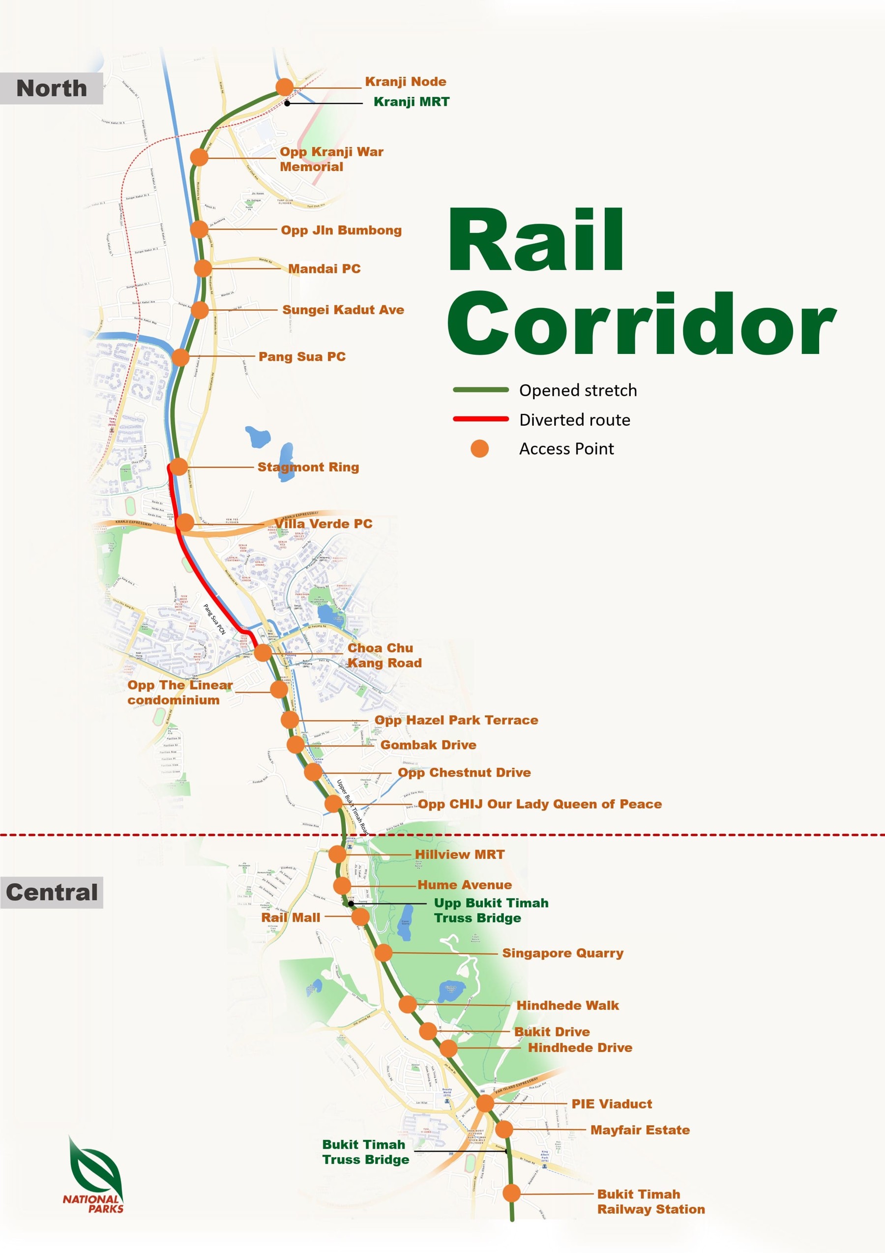
For the through-walk, use the Hillview MRT access shown on the official map and head south towards Bukit Timah Railway Station. If you want the heritage stop first, reverse the direction. Decide whether you are returning by train before leaving home; finishing at your car doubles the walking commitment.
For a station-only visit, NParks directs visitors from King Albert Park MRT Exit A: turn left along Bukit Timah Road and walk about five minutes to the landscaped entrance. There is no carpark at the station community node.
Four landmarks that keep the walk legible
Use the named access points on the official North/Central map, rather than a straight line on a fitness app.
Upper Bukit Timah Truss Bridge
Rail Mall area
The northern heritage bridge is near the Rail Mall access. Stop clear of the walking line for photos. The older detailed access map identifies stairs at the bridge’s southern end, so this exit is not a step-free fallback.

Singapore Quarry access
Central corridor
This is an identifiable exit on the corridor map. Continuing on the main corridor keeps your plan simple; turning off towards the quarry creates a separate nature-park visit with its own opening hours and walking distance.
Official details →Hindhede and Bukit Drive accesses
Middle of the Central section
The map marks Hindhede Walk, Bukit Drive and Hindhede Drive separately. These are useful decision points if someone wants to stop early. Read the access sign before leaving the corridor, as the paths do not all emerge at the same road.
Official details →Bukit Timah Truss Bridge and railway station
Southern end of the Central walk
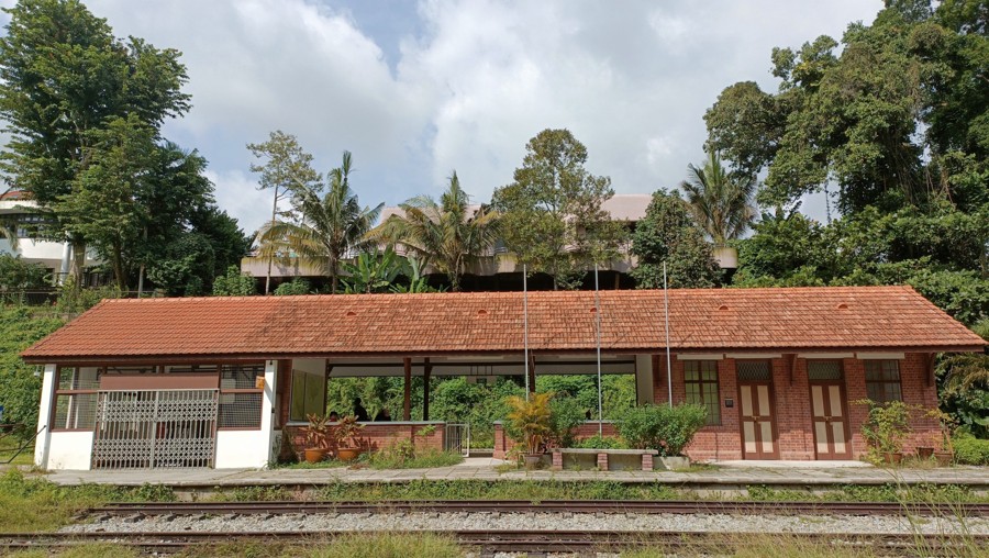
Continue past the bridge towards the station node. The gallery preserves railway equipment and the precinct includes gardens, a sheltered yard and toilets. The Signal Room is viewed from its entrance, not entered.
Official details →If you only want an easy heritage outing
Stay within the wheelchair-accessible station community node: look at the conserved building, then the gardens and yard shelter. This is a different proposition from treating the whole corridor as step-free. The former staff quarters now house a café, but check its own service days before relying on it for food.
Surface, weather and current notices
NParks’ May 2026 advisory warns of uneven sections as tree roots grow near the surface. Slow down, watch your footing and put your phone away while moving. The corridor is shared with cyclists; keep left and leave room for others.
The route is largely unlit to support nocturnal wildlife. Limited lighting at access points is not a reason to plan an evening through-walk. Avoid forested areas during and immediately after bad weather.
At our check, the prominent closure notice concerns Rail Corridor South between Henderson Road and Spooner Road, not this Central itinerary. Do not turn that into a claim that all 24km are continuously open. Recheck the live notices before extending your walk.