Queenstown’s housing story, seen from its public streets
Queenstown makes more sense as a housing-history walk than a checklist of photogenic blocks. Compare early HDB flats, the organisation’s former headquarters and a later generation of public housing, without treating residents’ homes as visitor attractions.
This is an outdoor, self-directed selection of stops, not a promise of entry into buildings or a replacement for a booked community tour. Choose a shorter cluster if the weather turns.
Start with early housing at Stirling Road
NHB’s My Queenstown Heritage Trail identifies Blocks 45, 48 and 49 Stirling Road among the first blocks completed by HDB, in October 1960. That places them within months of the board’s formation, rather than simply making them “old flats”.
Look from the public approaches at the block layout and relationship between homes and shared space. The point is to compare how housing is arranged, not to photograph through windows. Keep entrances, lift lobbies and routes used by residents clear.
Three stops with three different questions
Use the NHB Queenstown trail overview to select the clusters before setting off. These are suggested subjects for an architectural walk, not a measured or waymarked route.
Stirling Road’s early blocks
Blocks 45, 48 and 49 Stirling Road
Start with the scale of the early estate. What can you notice about spacing and everyday circulation from the public paths, without going upstairs?
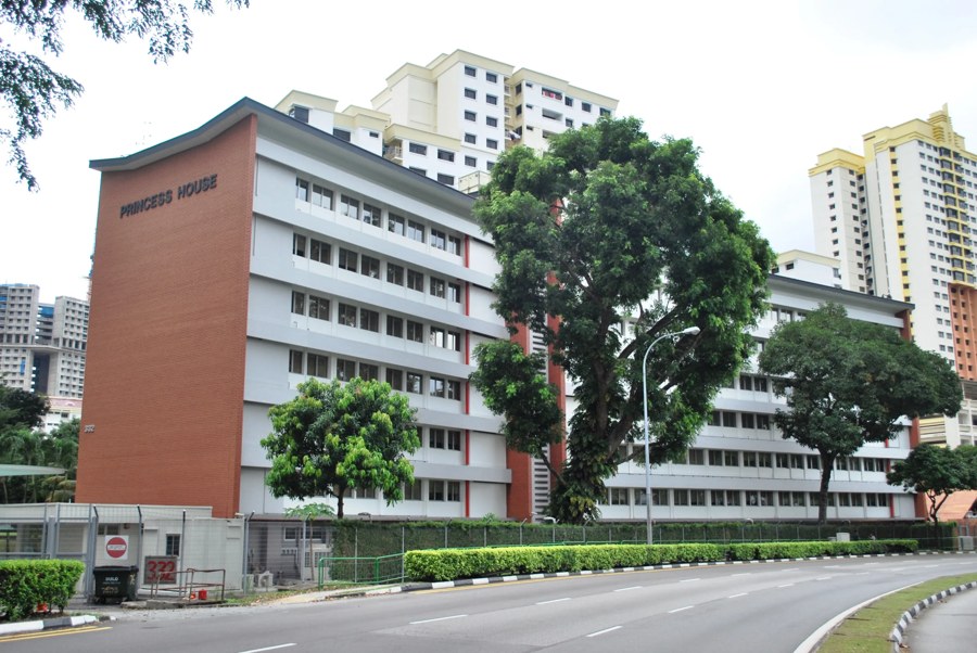
Official details →Princess House
332 Alexandra Road
The former HDB headquarters provides an institutional counterpart to the homes. View the modern building from the public footway; this plan does not include access to its grounds or interior.
Official details →SkyVille @ Dawson
85–88 Dawson Road
Finish by comparing a newer public-housing development. Observe the towers and shared ground-level spaces without entering private residential corridors.
Official details →Why Princess House and Dawson belong in the same walk
URA describes Princess House as a 1950s building first associated with the Singapore Improvement Trust and subsequently HDB’s first dedicated headquarters. Looking at the exterior adds the planning institution to a walk that could otherwise be only a succession of residential blocks.
At SkyVille, architect WOHA explains a design organised around community, variety and sustainability, including shared terraces known as Sky Villages. That gives you a useful comparison with Stirling Road: how does each development make space for neighbours to meet? Although the architect describes public spaces at height, this itinerary does not depend on rooftop access or assume that every lift and terrace is available on your visit.
Practical limits: the library is not your indoor fallback
Queenstown Library’s last operating day was 30 August 2026, ahead of redevelopment and a planned reopening in late 2028. Do not use an old neighbourhood itinerary that promises an indoor library break. Check NLB’s closure announcement when planning around the building.
Start in daylight, bring water and use legal pedestrian crossings between the road clusters. The map is for orientation, not evidence of a continuous sheltered or step-free route. If rain arrives, shorten the walk rather than entering private premises for shelter.
Keep photography focused on architecture, avoid identifiable residents without permission and leave conversations or guided access to properly arranged community programmes. A modest three-stop walk can tell a clearer story than collecting every historic building in one afternoon.