Labrador: plan a coastal walk, not the closed creek boardwalk
Berlayar Creek Boardwalk is closed for improvement works, with completion expected on 31 March 2027. Do not plan the familiar mangrove-boardwalk approach from Labrador Park MRT as though it is open.
A visit can still focus on Labrador’s waterfront, heritage markers and Keppel Coastal Trail. Use the official road-side diversion and keep the reserve’s separate hours in mind.
Get in using the published diversion
The closure map marks the alternative route in orange along Labrador Villa Road and Port Road into the park. Follow that route and on-site signs rather than trying to bypass barriers beside the creek.
The pavilion at the creek approach is closed too. NParks identifies Labrador Park MRT as the nearest shelter at that end. If your real destination is Reflections at Keppel Bay, its closure FAQ suggests public transport along West Coast Highway or using Telok Blangah MRT instead.
Build a visit around these open-area choices
Start with the waterfront and add the coastal trail if the group is comfortable continuing. These are choices, not a compulsory circuit through every historic path.
ComChest Green
Waterfront park
Use this therapeutic garden area as a gentle first stop after the diverted approach. It offers a place to pause rather than heading straight uphill. The official map shows the coastal path and nearby Toilet C; check local signs for any day-specific changes.
Official details →Dragon’s Teeth Gate
Western waterfront
The landmark here is a replica of the former maritime rock formation. Treat it as a heritage stop on the public park path, not an invitation to explore the shoreline. The original formation was removed in 1848.
Official details →Keppel Coastal Trail
Coastal beach forest
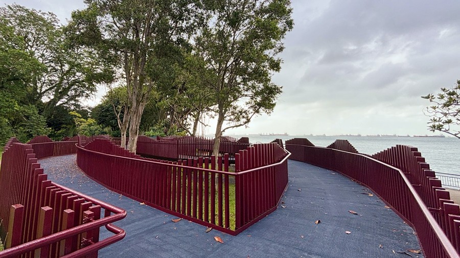
The trail combines a 250m rustic path with a 90m elevated boardwalk. NParks specifically identifies the boardwalk as wheelchair accessible. That does not mean the rustic section has identical surfaces or that every approach is step-free.
Official details →Restoration and swales
Along Keppel Coastal Trail
Read the interpretive panels about coastal habitat restoration. The swales beside the rustic path help drainage and create habitat; they are not a shortcut to the sea. This makes a useful slower stop for people interested in how the park is managed.
Official details →What to leave out for now
The live park notice also closes the Casemate and Rocky Shore for public safety. Separate slope works affect particular paths, a toilet and part of a playground. The slope-work map marks these in red; use designated alternatives and do not promise children that every play area is available.
Older coastal-walk brochures show a complete creek route. They remain useful background, but the current closure map takes priority. An expected completion date is not confirmation of reopening.
Make the return straightforward
Save the park map before setting off and return by the approved entrance route. Leave the nature reserve before 7pm even though the adjoining park remains open. Pets are not allowed inside the reserve; the park and boardwalk rules differ. Cycling and drones are not allowed.
Bring water and use footwear suitable for the rustic trail. During bad weather, skip the forest section rather than stretching the outing to complete a checklist. If the creek itself is your priority, postpone that part until NParks confirms reopening.