Heritage walks
Toa Payoh: read a housing town through its public spaces
Sources checked 1 November 2026
Toa Payoh’s heritage is visible in everyday housing and shared spaces. This outing is about comparing block forms, a town park and a playground, not entering residents’ corridors or turning the estate into an open-air museum set.
Choose between a short town-centre visit and the full official housing route. The dragon playground can be a separate extension rather than a compulsory finish for everyone.
Choose the length before starting
NHB’s Toa Payoh Heritage Trail offers three themes. The housing-and-shared-spaces route is 4.5km with a suggested walking time of 1.5 hours. A community-institutions route is 1.5km, while the faiths route combines walking and public transport. Do not assume that choosing a shorter theme includes every landmark below.
For our shorter selection, start with the Town Park and the town-centre housing views, then decide whether to continue. NParks places the park at the junction of Lorong 2 and Lorong 6, about five minutes from Toa Payoh MRT. Use the official NHB map for the full route instead of joining estate footpaths by guesswork.
Four things to compare
Each stop shows a different aspect of how a public-housing town functions. View buildings from shared public spaces and let residents go about their day.
Toa Payoh Town Park
Junction of Lorong 2 and Lorong 6
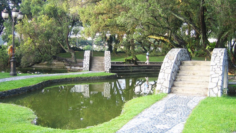
Start with the pond, bridges and landscaped setting. NParks describes the park’s popularity for weddings in the 1970s. The conserved lookout tower is a landmark to observe; this guide does not promise access to climb it.
Official details →Block 157
157 Lorong 1 Toa Payoh
NHB highlights this curving block as an example of HDB experimenting beyond standard linear blocks. Look at its form from public ground-level spaces rather than using residential corridors as viewing platforms.
Official details →Central Horizon
Blocks 79A–79E, Toa Payoh Central
The NHB map identifies the distinctive crown-like tops as a comparison with earlier housing forms. Treat this as a streetscape stop, not an invitation to visit rooftops or private communal facilities.
Official details →Dragon Playground
Lorong 6, near Blocks 31 and 264
NHB dates this dragon to 1979 and credits HDB architect Khor Ean Ghee. Look at the tiled head and ringed body as a different kind of public design. This is not the smaller dragon at Lorong 1.
Official details →How to follow the full housing route
If the group wants the complete official route, start from the NHB map rather than treating this selection as a substitute. The full trail includes Block 53, Block 116, The Peak, Block 157, Town Park, Central Horizon, the former 1973 SEAP Games Village and the dragon playground.
Give each stop a question: how does the building shape differ, where do people meet, and how are green spaces fitted into the town? You do not need to photograph every block or enter any building to get something from the comparison. Add time for crossings and reading the markers; the official walking estimate is not a timed challenge.
Access and a sensible stopping point
The Town Park is listed as wheelchair accessible and open 24 hours. That does not certify the entire heritage trail as a step-free route. Check each road crossing and avoid stairs if anyone in the group needs a level path. Daylight makes the building details and park stops easier to appreciate.
The trail map is a heritage resource, not a live construction notice. Follow current signs and do not cut through cordoned areas or construction sites to reach a marker. If a stop is inaccessible, skip it and keep the history through the linked official record.
Finish when the group has seen enough, with the town centre as a practical place to regroup. Save the longer northern housing section or places of worship for another outing rather than stretching a short family walk into the full network.